click to zoom
| Ditambahkan | Senin, Agustus 14, 2023 |
| Kategori | Gps Gps geodetic Produk |
| Harga | Hubungi Kami @ GPS Geodetic/GNSS HI-TARGET iRTK 5 Apa yang dimaksud dengan GNSS? GNSS (Global Navigation Satellite System) adalah suatu ... |
| Share | |
| Hubungi Kami | |
| BELI |
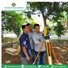
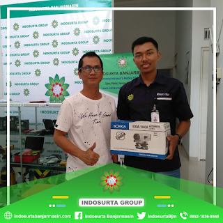
Review GPS Geodetic/GNSS HI-TARGET iRTK 5 di Banjarmasin (0852 1036 8569)

Hubungi Kami @
GPS Geodetic/GNSS HI-TARGET iRTK 5
Apa yang dimaksud dengan GNSS?
GNSS (Global Navigation Satellite System)
adalah suatu sistem satelit yang terdiri dari konstelasi satelit yang
menyediakan informasi waktu dan lokasi, memancarkan macam-macam sinar dalam
berbagai frekuensi secara terus- menerus, yang tersedia di semua lokasi diatas
permukaan bumi.
Apa bedanya GNSS dan GPS?
GNSS merupakan salah satu teknologi
penentuan posisi yang terdiri dari gabungan atau kumpulan sistem satelit GPS dari
Amerika Serikat, Glonass dari Rusia, Galileo dari Eropa, Compass/Beidou dari
China, IRNSS dari India dan QZSS dari Jepang. GPS adalah
sistem navigasi dan penentuan posisi menggunakan satelit.
Apa fungsi dari GNSS?
GNSS berfungsi sebagai satelit pemancar
sinyal. Sinyal-sinyal inilah yang menunjukkan dimana letak kita secara akurat.
Tanpa letak yang jelas, banyak hal yang tidak bisa kita lakukan, seperti
mengarahkan jalur penerbangan atau memberi pertolongan pertama.
Spesifikasi GPS Geodetik/GNSS Hi-Target iRTK 5
Satellite
Signals Tracked Simultaneously
- Channels:
336
- GPS:
L1C/A,L2E,L2C,L5
- BeiDou:
B1, B2, B3
- GLONASS:
L1C/A, L1P, L2C/A, L3 CDMA
- Galileo:
E1, E5A, E5AltBOC, E6
- IRNSS:
L5
- SBAS:
L1C/A, L5(QZSS, WAAS, MSAS, GAGAN)
- Global correction service: Hi-RTP/RTX (optional)
Positioning
Performance
- High Precision Static
- Horizontal: 2.5 mm + o.1 ppm RMS
- Vertical: 3.5 mm + 0.4 ppm RMS
- Static and Fast Static
- Horizontal: 2.5 mm + 0.5 ppm RMS
- Vertical: 5 mm + 0.5 ppm RMS
- Post Processing Kinematic (PPK / Stop & Go)
- Horizontal: 8mm + 1 ppm RMS
- Vertical: 15mm + 1 ppm RMS
- Initialization time: typical 10 min for base and 5 min
for rover
- Initialization reliability: typically > 99.9%
- Code Differential GNSS Positioning
- Horizontal: 25 cm RMS
- Vertical: 50 cm RMS
- SBAS: 0.5 m(H), 0.85 m(V)
- Autonomous
- Horizontal: 1 m RMS
- Vertical: 1.5 m RMS
Real
Time Kinematic (RTK)
- Single Baseline
- Horizontal: 8mm + 1ppm RMS
- Vertical: 15mm + 1ppm RMS
- Network RTK (VRS,FKP,MAC)
- Horizontal: 8mm + 0.5ppm RMS
- Vertical: 15mm + 0.5ppm RMS
- Initialization time: typically 2-10s
- Initialization reliability: Typically > 99.99%
- Hi-Fix
- Horizontal: RTK + 10 mm/minute RMS
- Vertical: RTK + 20 mm/minute RMS
- Tilt Survey Performance
Additional horizontal pole-tilt
uncertainty typically less than 10 mm +0.7 mm / °tilt (2cm accuracy in the
inclination of 30 under good condition)
Hardware
- Physical
- Dimension (W x H): 158mm x 98mm (6.22 inch x 3.86
inch)
- Weight: lighter than 1.3kg (2.65lb) within internal
battery
- Operation temperature: -40°C ~+ 75°C ( -40°F ~+ 167°F
)
- Storage temperature: -50°C ~+ 85°C ( -58°F ~+ 185°F )
- Temperature control: Auto-adjust the working power to
maintain the temperature
- Humidity: 100%, condensing
- Water/dustproof: IP67 dustproof, protected from
temporary immersion to depth of 1m (3.28ft)
- Shock and Vibration: MIL-STD-810G, 514.6
- Anti-salt spray: MIL-810G, 509.4, 96h
- free fall: MIL-STD-810G, 516.6, designed to survive a
2m(6.56ft) natural fall onto concrete.
- Electrical
- 6V to 28V DC external power input(5-pin port), with
over-discharge protection power consumption 4.4W Automatic switching
between internal power and external power.
- Control Panel
- Physical button: 1
- Display: 240 x 240 pixel, 261 ppi
- Touchscreen: Support glove mode and wet-finger mode.
- Internal Battery
- 7.4 V, 6800 mAh lithium-ion rechargeable and removable
battery.
- RTK rover(UHF/Cellular) for 10 hours.
- Power indicator embedded.
- Quick charger within 3.5 hours.
- I/O interface
- Bluetooth 4.0/2.1+ EDR, 2.4 GHz. USB 3.0 port, OTG
function. 1 SMA antenna connector.
- 1 DC Power input(5-pin), 1 SIM Card slot.
- Near Field Communication(NFC).
Communication
- Network Communication
- Full band support for cellular mobile network(LTE,
WCDMA, EDGE, GPRS, GSM).
- 2.4GHz Wi-Fi, supports the standard protocol 802.11
b/g/n. Network RTK(in CORS) range is 20-50km
- Internal UHF Transceiver Radio
- Frequency: 403~473MHz
- Transmitting power: 1~4W Hi-Target Advanced Radio
- Support Protocols: Hi-Target, TRIMTALK450S, TRIMMARK
III, SATEL-3AS, TRANSEOT, etc.
- Working Range: Typically 3~5km, optimal 5~8km.
- External UHF Radio
- Frequency: 410~470MHz.
- Transmitting power: 5W / 25W.
- Compatible with third party radio.
- Working Range: Typically 8~10km, optimal 15~20km.
System
Configuration
- System
- Data Storage: Circulating 16GB Internal storage Record
GNS and RINEX format simultaneously.
- Data Formats

.png)